
My previous hike throughout Mission Trails Regional Park was a great introduction to get my feet moving, get the blood pumping, and a way to begin quenching my inextinguishable thirst to travel, wander, and get away from the norm. However, the power lines that buzzed overhead and the constant views of rooftops and distance cityscapes had me yearning for something a little more remote. After doing a little bit of research on some of the best hikes around San Diego, I came across the Modern Hiker website. This site was a wealth of information that allowed me to browse through multiple hikes to read more about them, see some pictures, and make my decision. After perusing the site for a couple of days, I decided on the Big Laguna Trail located just outside the small town of Mt. Laguna.
[embedyt] http://www.youtube.com/watch?v=y9uOxpONtOk[/embedyt]
Sleeping in late on this Saturday morning? Fuhgeddaboutit. Well, I guess if sleeping in until 6:30am is your idea of sleeping in, I slept in. I was on the road by about 7:30, pointing my red chariot east along I-8 toward the Cleveland National Forest. I took the Sunrise Highway exit for about 11-miles toward the town and parked at the Mt. Laguna campground. This is where I started my long, 18-mile hike that led me through some beautiful oak and pine woodlands, down a winding path into Noble Canyon, and eventually dropped me out onto the Pacific Crest Trail.
Guided by Something, Yet Nothing at All
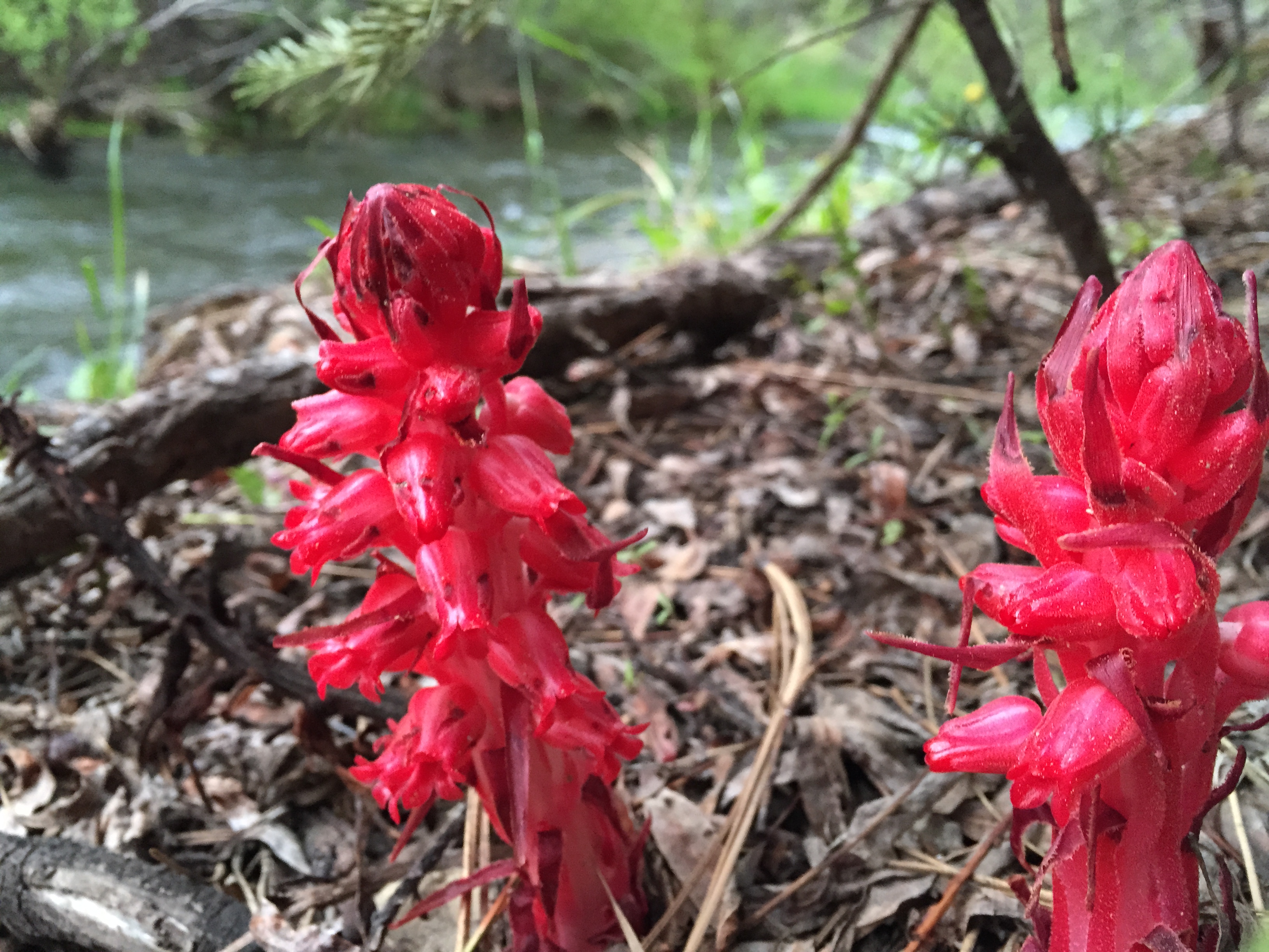
I bet I wasn’t more than 50 steps into my hike when I felt a giant smile come over my face and felt a great sense of excitement begin to stir. Oh, the smell of the pine trees and the bright blue skies hovering overhead was exactly what I was seeking. With new hiking shoes ready to rock, I hit the trail and began my march into an unknown world that would lead me wherever my feet decided. I had downloaded a very cool app called AllTrails the night before which would use my phone’s GPS to track my route, and would offer a bit of guidance of where I should be headed. With that set to go, I barreled forward past a giant meadow, through woodlands and wildflowers that you would never expect so close to the coast of San Diego.
From the air, you realize just how big the Earth is, but on foot you realize just how small you are.
–Johnny Caito

It was a beautiful day, hovering somewhere around the mid-60’s with bright blue skies, a nice pleasant breeze, and only minor foot traffic on the trail. Occasionally, a group of mountain bikers would pass by, but for-the-most-part the trail was mine. The Cleveland National Forest was feeling my shoes pound against its surface, being dominated by this unstoppable force. Okay, maybe not to that extent, but I was taking a nice stroll through the wilderness with nothing but the birds, the wind, and myself to keep me company. There were no rooftops, no humming of wires, no buzzing of the highways, no crying, bickering, sneezing, slurping, chugging, moping, moaning, or any type of undesirable noise pollution to get in my way. It was me and the trail bound together with one thing in mind…keep moving forward.

I pushed on, minute after minute, hour after hour (isn’t this from the song Gangsta’s Paradise by Coolio?), and mile after mile. I knew my mission was to eventually cross over the Sunrise highway which was further to my east and then make my way back south to my starting position. After a couple of quick glances at a map, I wasn’t exactly sure how far and how long this would take.

Approximately five hours later I had finally reached Sunrise Highway and met up with the Pacific Crest Trail. By this time, I was starting to become a bit tired and began to feel the miles taking their toll on my feet and hips. It was the constant urge to see what awaited me around that next bend that kept my trucking and kept me motivated.

Connecting with the Pacific Crest Trail
The Pacific Crest Trail (PCT), is one of the most famous hikes in the world, beginning at the U.S./Mexico border and traversing along the spine of California, up through Oregon and Washington, before ending after 2,650 miles at the border of Canada. As I was making my way south, a trekker was marching toward me with a large pack and forcefully stabbing at the surface of the earth with his sleak trekking poles. We stopped and chatted for a few moments I asked him whether he was hiking all the way though. He was, indeed…at least that was his goal, which he assessed would take him roughly five months. He suggested that I check out Garnet Peak on my journey south to get some incredible views to the east toward the Sultan Sea and down into the dry desert. Sounds like a plan. I’ll give it some thought.

There it was, the sign pointing in the direction of Garnet Peak. I looked up at the trail that angled steeply uphill, seemingly enticing me to give it a shot. By now my feet were aching but my mind kept saying, “you’re here…how can you not go up there and take a look?” I debated for a moment or two, and thought, “you’re here. Let’s do it.” The half a mile trek to the top had me sweating and panting a little bit, but it felt good to be challenged at this point. “How can I go on a hike and not have a goal? What better goal than reaching a “peak?” I thought. As I reached the top and looked down on the steep valley and the vast desert that extended as far as the eye could see, I knew it was worth it. Spinning around gave me an incredible vantage point to admire the green woodlands to the west and the pale, whitewashed deserts to the east.

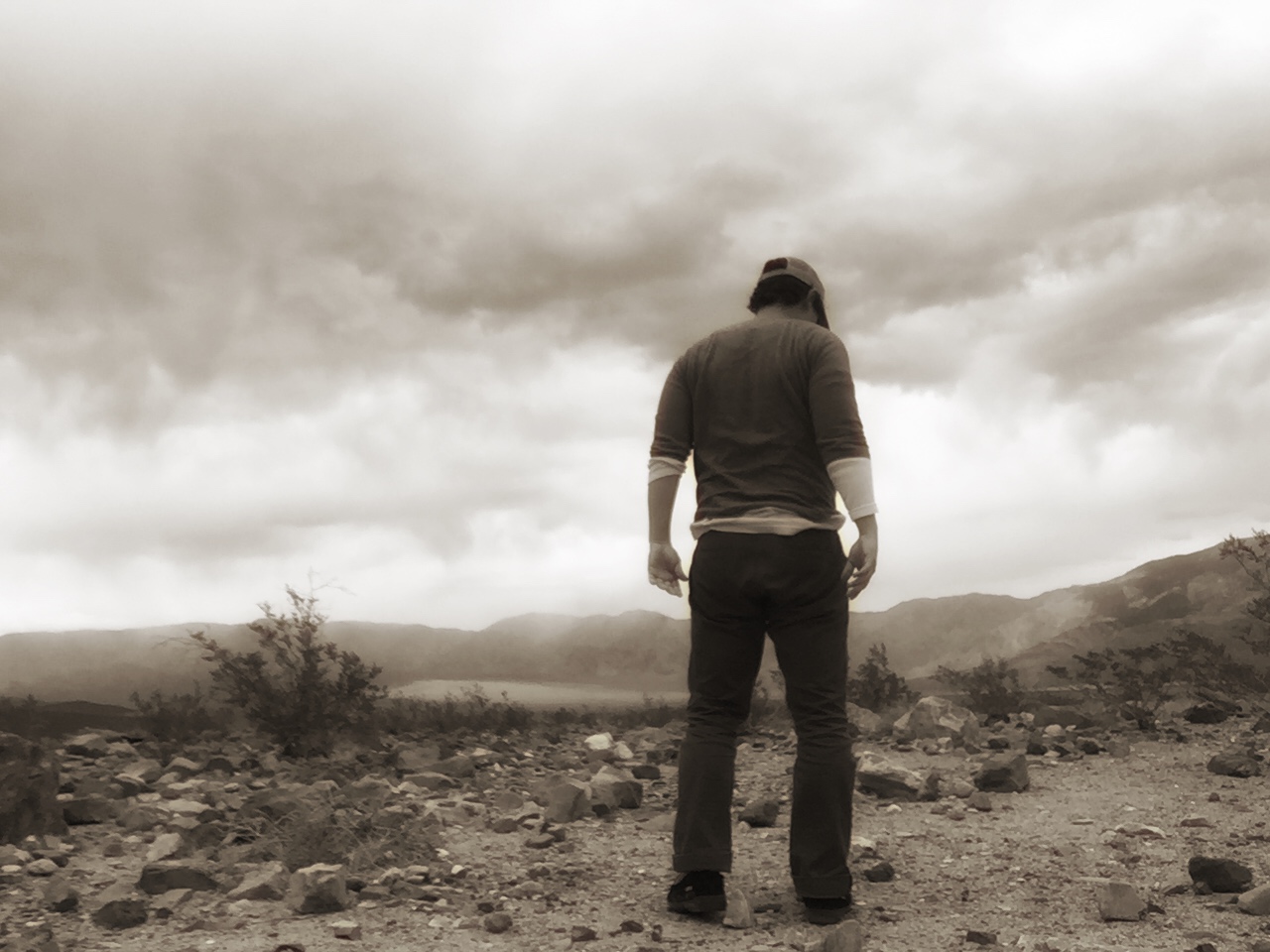
The World is Big. We Are Small. No Kidding
As I made my way down from Garnet Peak and continued my journey even further south, I couldn’t help but think about the vastness of the world, the wilderness, and our surroundings. From the air, you realize just how big the Earth is, but on foot you realize just how small you are. One step after another eventually compounds to get you to where you need to be, but a single step essentially gets you nowhere. It’s a constant battle of your will and your desire, fighting together to reach your destination. For some reason, after walking alone for hours, traversing past beautiful Jeffrey pines, crooked oaks, and along the spine of the state, things in life kind of make more sense. The noise pollution has escaped and the nonsense that spews from the radio, television, and other media sources disappears and allows you to see the world more clearly. It’s truly a remarkable thing.
The World Was a Carpet Laid Before Me
Unfortunately, my GPS tracker had to be turned off because my phone was beginning to die, but at the point that I had turned it off, I was at more than 11-miles. After a close inspection of some maps, it appears that my total distance traveled was more than 18-miles. By the time I reached the end, my feet were screaming bloody murder, asking to be released from the confines of my dusty, now trail-tested shoes. My hips were tightening, and a couple of times I let out some audible moans and grunts that sounded something along-the-lines of a bear mating call. As I reached my car, I had been walking for just under nine hours, stopping very briefly just a handful of times. As I collapsed into the front seat, I felt a great sense of accomplishment, a rush of euphoria and excitement emanating from within. Before I could even exhale, I immediately began to think, “where do I go next?”


